Our Hikes in 2017, with the most recent at the top
A Walk from Kenilworth Led by Bob Reid
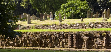
This walk started from the Abbey Fields carpark in Kenilworth, CV8 1BP. The car park is FOC on Sundays. The walk was approximately 8.5 miles long.
The walk commenced by crossing Abbey Fields to the road leading to the castle car park and turns right down a track just past the castle entrance. Go through a gate on the left to follow a path around the castle on the right to Purlieu Lane. Turn left along Purlieu Lane to a gate on the right way marked Millennium Way, proceed along Millennium Way across several fields to Chase Lane. Turn left on Chase Lane and continue past Chase Wood. Turn left at the end of Chase Wood down a farm track and then right at a way mark, through a hedge over a footbridge and up the a hill with the hedge close on the left, through a gate and turn left to another gate , Go through this gate and maintain direction across the field to a gate onto Church Road. Turn left onto Church Road and proceed past Honiley Hall and follow the road to Beausale keeping left at the screwed T-junction. Shortly past a cross roads with Dirty Lane turn left down Barracks Lane.
A Walk from The Hatton Arms led by Angus & Tracey Mills
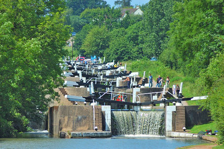
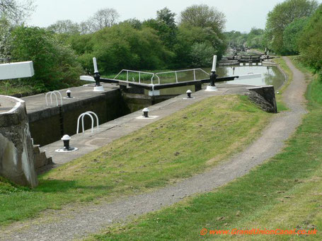
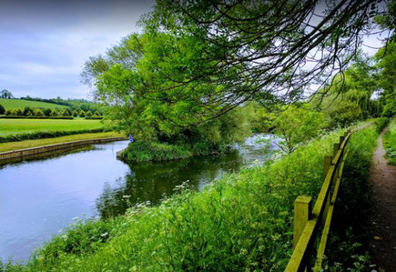
This walk from the Hatton Arms, CV35 7JJ is a circular walk of about 10 miles, initially heading towards Warwick along the canal, leaving via a footpath by the locks at bridge 49, passing Woodloes Farm, skirting around Warwickshire Golf course and heading back to the Hatton Arms via Goldrest Farm, Bulloak Farm and Lower Farm. Easy walking: predominantly, a mixture of canal towpaths, urban footpaths and bridleways.
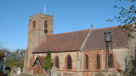
Rural walk around Berkswell and Balsall Common led by Bob Reid
This walk begins from The Brickmakers Arms, Berkswell, CV7 7EG. Cars may be parked at the pub or in the nearby station car park, CV7 7EF. The walk is just under 9 miles long with no steep inclines.
It is a rural walk through agricultural land and proceeds from The Brickmakers Arms through Barratt's Lane Farm, Beechwood, Carol Green, Benton Green to Berkswell village. From the village it follows the Heart of England Way to Balsall Street and then winds back past Grange Farm and through Balsall Common to The Brickmakers Arms.
Walk from The Stag at Offchurch
This walk starts from The Stag at Offchurch, CV33 9AQ and is approx 10 miles long. Please park in the Stag overflow carpark which is clearly signed to the left of the main carpark.
From Offchurch the walk heads northwards across several fields to the Millennium Way and thence to Hunningham Hill and then South along Ridgeway Lane to Snowford Lodge. Here it turns east along the Millennium Way to Long Itchington and then to the Grand Union canal where it proceeds west along the towpath past Bascote locks. Exiting from the canal back onto Ridgeway Lane and then onto Welsh Road for 1/4 mile and then across fields back to The Stag.
Barnt Green & Lickey Hills Circuit
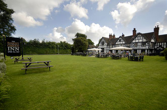
A walk from The Barnt Green Inn (Address: 22 Kendal End Road, Rednal, Birmingham, B45 8PZ. Directions)
The walk heads east to the Bittell Reservoirs then back west through Cofton Hackett and into the Lickey Hills and over the golf course. The route then returns to Barnt Green via Beacon Hill and Bilberry Hill.
Two Breweries Walk

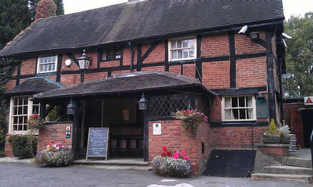
This walk starts from The Lord Nelson Inn, Birmingham Road, Ansley, Nuneaton, Warwickshire CV10 9PQ (Google Maps). Please note that the pub requests that walkers do not use their car park, but there is plenty of roadside car parking nearby (eg, in Nuthurst Crescent). The walk includes visits to The Sperrin Brewery at the Lord Nelson and to the Church End Brewery. Detailed route guidance follows below the photo gallery.
A Walk from the Queen's Head, Meriden
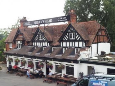
A walk led by Gill Shalley from the Queen's Head, Meriden, CV7 7JP (Google Maps) via Eaves Green, Harvest Hill and Millison's Wood and back. Car parking is free in the car park next to the pub.
A Walk from Fenny Compton led by Mary Coles
This walk starts from The Merrie Lion in Fenny Compton, CV47 2YH (Google Maps). Cars may be parked in the pub car park on the understanding that refreshment will be taken at the end of the walk. Parking space is limited, so please car share where possible.
The walk is about 8.5 miles taking in the gentle rolling hills of Warwickshire. It progresses from Fenny Compton to Farnborough passing the impressive Farnborough Hall and then to Avon Dassett church and a short climb to the top of the Burton Hills with fabulous views across Warwickshire and beyond with the Malvern Hills visible on a clear day. It then drops down to Northend and back to Fenny Compton for aforementioned refreshment.
A Walk from Combrook Led by Lou Pearson
This walk is about 9.5 miles in length and you can park in the vicinity of St Mary & St Margaret Church (post code is CV35 9HP)
In the summer, some of the paths through woodland areas get a little overgrown with brambles so it is advisable to wear long trousers.
A walk from Barton led by Kay Dick
The walk starts from Barton Car Park B50 4NP. (Car Park Charge old £1.00 coins only). From the centre of Barton village, follow the Welford-on-Avon road for 1/2 a mile, go past Dovecote Riverside Caravan Park and Moorings, and the car park is then on your left (see the car park here on Google Streetview). The walk is approx 7.5 miles and will take about 3 hours.
From the car park take the footpath on your right. Follow the path along the river Avon to Welford on-Avon. Take the path on the right into the village until you get to St Peters Church. Turn right along Headland Road, passing Welford Primary School. At the end of the road, take the footpath opposite, following the path to the end. Turn right, through fields until you come to a road, turn left. Through Hunt Hall Farm take the gate on your right through fields. Crossing a Farm Lane, field, footbridge, 2 small fields (horses are in these fields). At the road turn right, through Dorsington village, take second right.
A Walk from Hampton to Catherine-de-Barnes and back via Ravenshaw and Eastcote
A walk from Hampton to Catherine de Barnes Common - "Catney Common", the only common land in Solihull - along the footpath above the Grand Union Canal to Damson Parkway. From there, along the towpath and across fields to Ravenshaw Hall and then via Eastcote back to Hampton.
Many thanks to Gill Shalley who planned and led the walk on 29 Jul 2017 when we started and finished at The Hampton Gym. There are many places you can choose to start and finish this walk; the route below is for a walk starting and finishing at The White Lion in Hampton where there is customer parking.
A Walk around Coventry City Led by Sarah Meharg
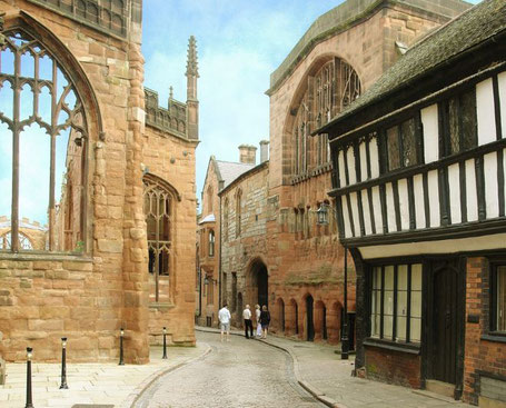
This walk is a guided tour of Coventry City centre led by Sarah with Eleanor Nesbitt as our guide. The walk will commence at Coventry train station at 13.45 and will take approximately 2 hrs. The walk will be on flat pavements, and will include Spon St., the Canal Basin, the Guildhall and lots more.
After the walk, some light refreshments then return either from Coventry station or by walking 3 miles through Memorial Park to Tile Hill station.
Dr. Eleanor Nesbitt is an Emeritus Professor in the Warwick Religions and Education Research Unit and has devised several walks in Coventry - this one combines parts of her Industrial History trail with part of her Literary Trail that you can view and download at this link.
A Walk from the Fleur de Lys, Lowsonford via Buckley Green and Copt Green
This walk of approx 7 miles / 11 km was led by Kay Dick from the car park of the Fleur de Lys, Lowsonford (B95 5HJ). Walk directions:
From the pub car park turn right down the road to a telephone box and there take the footpath on the left and follow the Heart of England Way through a field on the right over a stile, cross two fields and then over a stile into a lane, turn right. After a short distance turn left through a double kissing gate and proceed along the edge of a field with the hedge close on the left to a wood, follow the HoE way through the wood.
A Walk from the Three Horseshoes Inn at Bubbenhall Led by Bob Reid
This walk will commence at the Three Horseshoes Inn in Bubbenhall, CV8 3BD, at 9.00 am. Cars may be parked at the pub. The walk is approx. 10 miles long with moderate gradients.
The walk follows the Coventry Way for about a mile and then cuts across fields to Shakespeare's Avon Way which it then follows south to Hunningham passing near to Weston under Wetherley. From Hunningham it proceeds north to Wappenbury and continues northward through Wappenbury Wood and then back to Bubbenhall.
A Walk from The Hampton Gym to Barston, Balsall St and back
This walk starts from The Hampton Gym, follows footpaths to Barston and Balsall Street, the Millennium Way/Heart of England Way to the West Midlands Golf Club and then footpaths back to the gym.
Starting from the Hampton Gym walk down Old Station Road to Meriden Road, turn right along Meriden Road crossing when safe and then turn left into Fentham Road. At the end of the road take the footpath on the left and follow it straight across fields and a small footbridge until until Oak Lane is reached.
Turn right and then left onto Barston Lane passing the Bulls Head pub. At the church, go through the churchyard via a path on the left which is followed around to the left past a path on the right which is not taken. At the end of the field go through a gate and follow the path across fields, crossing the river Blythe, until Barston Lane is reached and then turn right to Balsall Street.
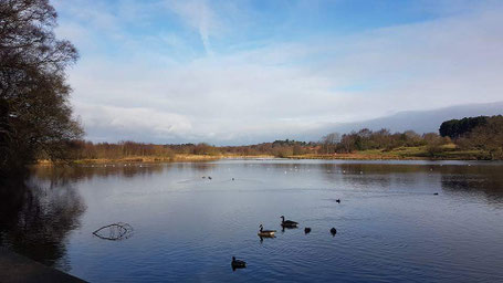
A Walk from Shustoke Reservoir led by Sharron Maguire

The walk will start from Shustoke Reservoir car park, B46-2BE, at 9.00am. and is about 9 miles in length, however there is a 4.5 mile version for anyone requiring a shorter distance.
From the car park the walk proceeds round the west and north sides of the reservoir to join with the Heart of England Way which is followed south to Dumble Wood. Anybody walking the shorter distance will leave the main walk here and head back in a north westerly direction to Shustoke via Hall Farm. The main walk continues to follow the Heart of England Way heading east and south east to High House Farm where it leaves the HoE way and proceeds south west to Broadmoor Wood. Here it turns north west and north back to Dumble Wood and thence back to Shustoke via Hall Farm.
A Circular Walk from Tanworth-in-Arden Led by Mary Coles

The Walk will start from The Bell in Tanworth in Arden, B94-5AL. Car parking is available at the rear of The Bell for those stopping for a drink at the end of the walk otherwise park on the Green.
This walk of around 9 1/2 miles explores the beautiful Warwickshire countryside. Starting from the Tanworth churchyard it proceeds across farmland crossing the Hobbditch to Ullenhall and from there over further farmland to Gorcott Hill, Traps Green and Aspley Heath back to Tanworth. The walk is over undulating countryside with several gradients of low to medium severity.
A Walk from the Crabmill at Preston Bagot led by Bob Reid
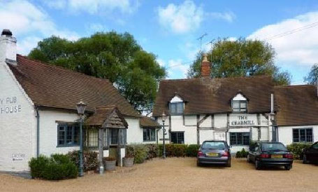
This walk from the car park at The Crabmill at Preston Bagot starts across country to the outskirts of Henley in Arden and then along the Heart of England way via Beaudesert Castle to the Millenium Way for some 2.5 miles to Copt Green. From there it proceeds via Bushwood Grange past Bush Wood to Preston Field Lane and then to the Stratford Canal for about 1/2 mile back to the Crabmill.
There are a number of steep gradients both up and down along this walk. The views over rural Warwickshire from the top of some of the hills are truly spectacular.
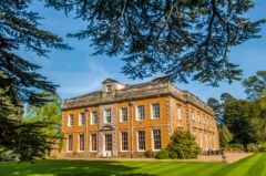
A Walk Led by Gill Shalley from Coughton Court
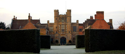
This walk of 11 miles leads to two National Trust properties, Coughton Court and The Kinwarton Dovecote, and follows the lovely River Arrow for some of its length.
The walk starts at The Throckmorton Arms (Coughton Hill, A435, Alcester, Warwickshire B49 5HX) and passes along the frontage of Coughton Court which is an imposing Tudor house set in beautiful gardens. Coughton Court is the home of the Throckmorton family who have lived at Coughton since 1409. John de Throckmorton, Under Treasurer of England to Henry VI, acquired Coughton in the early 15th Century through his marriage to Eleanor de Spiney. Their descendants have held it for 600 years and, although the National Trust has owned the house since 1946, the family still live here. The origins of Coughton Court lie in pre-conquest times: the present building was begun in the 15th Century. The walk also passes two beautiful churches in the grounds.
Edgbaston and Harborne by towpath from the ICC

This route begins from the rear of the ICC in Birmingham and is about 8 1/2 miles long. From the rear of the ICC the route goes to the Edgbaston Reservoir via the Birmingham Canal, into Summerfield Park and then along the Harborne Walkway into Harborne. The middle section takes in some interesting residential streets, featuring fine examples of Victorian terraces and some of the grandest houses in Birmingham. The last stage picks up the Worcester & Birmingham Canal near the University and returns to the ICC past the Mailbox and Gas Street Basin.
A Walk Around Sutton Park led by Gill Shalley
This walk was approximately 8 miles long and started from the car park of the Toby Carvery Sutton Park, Sutton Coldfield, B74 2YT (just inside the Town Gate of the park). The walk was around the perimeter of the park which is a 2,400 acre National Nature Reserve designated as a Site of Special Scientific Interest (SSSI). The park has open heathland, woodlands, seven lakes, wetlands and marshes - each with its own rich variety of plants and wildlife. Cattle and wild ponies graze on the land. Much of the walk is on semi-rough tracks with some wettish boggy areas. For more information about the park, and a map, please see Birmingham City Council website.
A Walk from The Green Man in Middleton, led by Sarah Meharg
This walk is from The Green Man in Middleton (Church Lane, Middleton, B78 2AN) and is about 7.5 miles. The route leaves Middleton through some muddy fields, then follows on to Drayton Bassett, along some farmland and then onto the pathways of RSPB Middleton Lakes. Our route does a lap of the lakes (dogs are not allowed on this lap, but there are other routes in RSPB Middleton Lakes on which dogs are welcome. Alternatively, if you have a dog you can just miss Middleton Lakes and continue straight on to the canal). After the lap of the lakes, the route continues along the Birmingham & Fazeley Canal for about a mile, and then follows a road past the Bodymoor Heath Training Ground of Aston Villa Football Club and back to the main Birmingham to Tamworth Road. After crossing the road, the route cuts along some country lanes before joining a footpath and returning to Middleton.
A Tour of Birmingham City Centre Canals led by Bob Reid

This walk around the canals of central Birmingham, is approx. 9 miles long and starts from Farmers Bridge Junction by the Barclaycard Arena. The whole way is on hard track towpaths.
From Farmers Bridge Junction take the towpath towards Aston, keep following the towpath on the left of the canal under several bridges and past many locks, passing the Post Office Tower on the right until Aston Junction is reached. Here join the Birmingham & Fazeley canal by keeping straight on and ignoring the first footbridge and then crossing the second footbridge over the canal to the towpath now on the right of the canal.
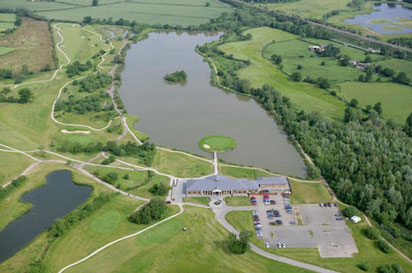
A Walk from Newbold Comyn Leisure Centre led by Angus Mills

This walk starts from the Newbold Comyn Arms car park, Leamington Spa, CV32 4EW and is approx. 9 miles distance.
With the Leisure Centre on your right and the pub car park on your left continue down the tarmac road into the park, passing adventure play areas on your right and a further car part on your left. Continue ahead until reaching a building. Take the footpath on the right (in front of the building) which crosses the River Leam before reaching the A425. Turn left here taking the footpath along the road and at a convenient point cross the road and continue down the footpath looking for a short flight of steps on the right which leads to the canal. Turn left down the canal passing under two canal bridges. Upon passing under the second bridge an old brick railway bridge comes into view; pass under the railway bridge and immediately turn left walking up a slope and on to the disused railway track (Cycle Route 41 – The Greenway).
